Have you ever wanted to explore the world from the comfort of your own home? Look no further than the Google Earth app! With features like 3D imagery, street view, historical imagery, and more, this app offers a virtual travel experience like no other.
What Is Google Earth App?
Google Earth is a powerful application that provides users with detailed satellite imagery, maps, and navigation tools to explore the Earth in a virtual globe format.
With Google Earth, users can virtually tour different locations, view 3D buildings, and even travel to the depths of the ocean with its interactive features. The app allows users to access historical imagery, measure distances, and explore the impact of climate change through time-lapse videos. Google Earth offers a plethora of information on landmarks, businesses, and natural wonders around the world, making it a valuable tool for both leisurely exploration and educational purposes.
What Are The Features Of Google Earth App?
The Google Earth app comes packed with numerous features that enhance the user experience, including 3D representations of cities, Street View for real-life exploration, historical imagery, Voyager guided tours, and tools like the Measure Tool for accurate measurements.
With its 3D representations of cities, users can virtually immerse themselves in various destinations worldwide to get a realistic sense of the surroundings. Street View allows users to explore the streets as if they were actually there, making it perfect for planning trips or simply satisfying curiosity.
Historical imagery enables users to witness how locations have evolved over time, offering a unique perspective on the past. Voyager guided tours provide curated experiences, guiding users through themed adventures. The Measure Tool ensures precision by allowing users to measure distance and areas with ease, facilitating planning and research.
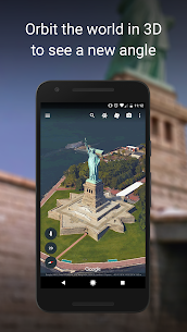
3D Imagery
Google Earth’s 3D imagery feature provides users with immersive views of cities, landscapes, and terrain, enhancing the visual experience of exploring locations around the world.
Street View
Google Earth’s Street View feature allows users to navigate and explore real-world locations with immersive 360-degree images, providing a dynamic and interactive experience enriched with real-time data.
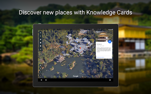
Historical Imagery
Google Earth’s historical imagery feature enables users to explore past views of locations, facilitating earth observation and the discovery of historical changes and landmarks over time.
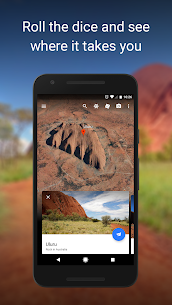
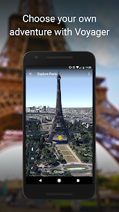
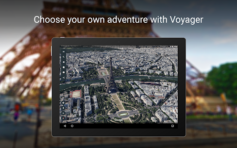
Voyager
Google Earth’s Voyager feature offers users an interactive experience with virtual tours of various places, enhancing exploration and learning through engaging narratives and visuals.
Measure Tool
The Measure Tool in Google Earth allows users to gather geographic data, perform measurements, and utilize GIS technology for accurate spatial analysis and planning purposes.
Bookmarking
Google Earth’s bookmarking feature allows users to save their favorite locations, create personalized travel itineraries, and revisit saved spots easily for seamless navigation and exploration.
How To Download And Use Google Earth App?
Downloading and using the Google Earth app is a straightforward process, whether on mobile devices or desktop computers, requiring minimal system resources for an optimal user experience.
- To begin the process, simply visit the App Store or Google Play Store on your mobile phone or tablet, or navigate to the Google Earth website on your desktop browser.
- Search for ‘Google Earth‘ in the store or website search bar and click on the download button.
Once the app is installed, launch it and customize your settings to personalize your experience. You can explore various features such as 3D maps, street view, and historical imagery, making it ideal for virtual travel and educational purposes. Remember to regularly check for updates to ensure you are accessing the latest enhancements and content.
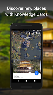
What Are The Benefits Of Using Google Earth App?
Using the Google Earth app offers numerous benefits, including access to high-quality satellite imagery, virtual exploration of world landmarks, educational resources, and cutting-edge technology for enhanced learning experiences.
The clarity and detail provided by the satellite imagery on Google Earth allow users to virtually travel the globe from the comfort of their own homes, making it an ideal tool for research, educational purposes, and even for planning future travel adventures.
The app’s educational resources cater to various subjects such as geography, history, and environmental studies, offering interactive tools that make learning engaging and informative. With its advanced technological features like 3D views and street view simulations, Google Earth continues to redefine how individuals explore and acquire knowledge about the world around them.