
With Google Maps, you can plan routes and measure distances between two points – as the crow flies. This way, for example, you can quickly determine how far two cities are from each other.
Quick guide: Measuring distances with Google Maps in the browser
1.Open Google Maps in your computer’s browser.
2.Type the location in the search box from which you want to calculate a distance or area.
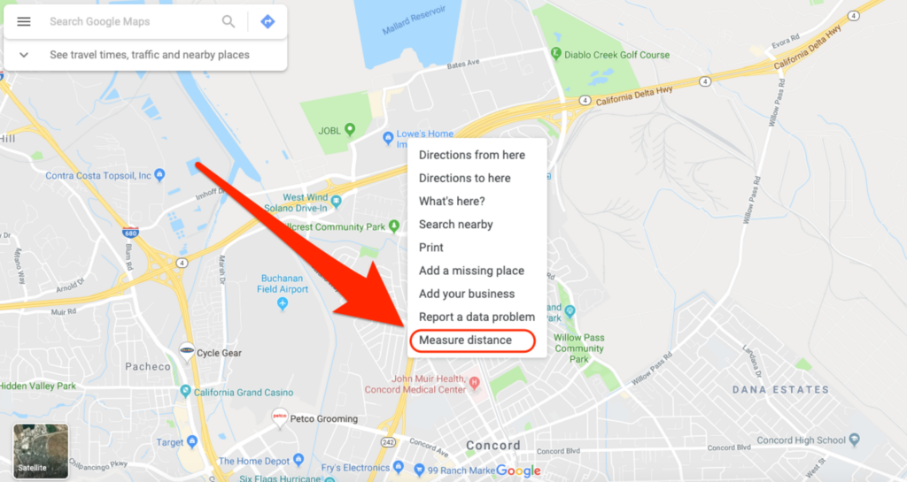
3.Right-click on your starting point and select “Measure Distance” from the context menu.
4.Then click on the map on the endpoint to which you want to calculate the distance. A black line with a kilometer indication will appear.
Quick guide: Measuring distances with the Google Maps app
1.Open the Google Maps app on your smartphone.
2.In the search box at the top, type a location from which you want to measure a distance.
3.Press and hold a point on the map until it is defined as a set marker.
4.Tap “Set Marker” at the bottom of the app. This will open the settings.
5.Select “Measure distance” here.
6.Now select an endpoint to which you want to measure the distance. Then tap on the plus symbol or on “Add point.”
7.To remove a point, tap on the arrow in the upper right corner. You can revoke the entire distance by tapping the three points and “Delete.”


Comments closed.